|
TERMS OF USE:
This free image can only be used for non-commercial, personal
website use only. THIS IMAGE CANNOT BE
used in galleries, downloaded to your computer, posted on sites for
others to use, manipulated, downsized, or upsized. If you are confused about the
terms of use or have any questions then contact us before using the image.
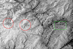
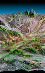
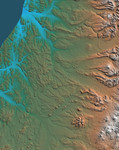
Free Picture: Kamchatka Peninsula, Russia
|
Description
Image of the western side of the volcanically active Kamchatka Peninsula, Russia. The data are from the first C-band mapping swath of the Shuttle Radar Topography Mission (SRTM). On the left side are four rivers, which flow northwest to the Sea of Okhotsk. These rivers are, from the south to north, Tigil, Amanina, Voyampolka, and Zhilovaya. The broad, flat floodplains of the rivers are shown in blue. These rivers are important spawning grounds for salmon. In the right side of the image is the Sredinnyy Khrebet, the volcanic mountain range that makes up the "spine" of the peninsula. The cluster of hills to the lower right is a field of small dormant volcanoes. High resolution SRTM topographic data will be used by geologists to study how volcanoes form and understand the hazards posed by future eruptions.
Keywords
amanina river, geography, jpl, kamchatka peninsula, rivers, russia, sea of okhotsk, sredinnyy khrebet, tigil river, voyampolka river, zhilovaya river, nasa, free photography, free photo, free photos, free picture, free pictures, free image, free images
|
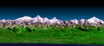
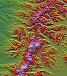
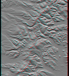
Similar Free russia Pictures
|
|
|
|