|
|
Home Stock Images Download Media Cart FAQs |
|
||
|
||||||
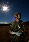
Description The CDC’s EIS officers worked in the Nigerian-Biafran war zone, further expanding the CDC’s efforts in eliminating malnutrition, and famine relief. Dr. William H. Foege was the CDC’s first EIS representative, and served as such from September until November, 1967. Dr. Lyle Conrad replaced him as an EIS administrator in December, 1967, and served there until March, 1968. Also in 1968, Paul Schnitker became the first and only EIS officer to die in the line of duty when his plane crashed en route to Nigeria. This image was created in 1967 and provided by the Centers for Disease Control and Prevention.
Keywords
|
| Privacy Contact About Image Collections Artist Login |
| Copyright © 2005-2013 Image Envision LLC All Rights Reserved Additional resources: Clipart, Logos |